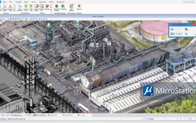
I took surveying in college many years ago. We used a transit, stick, chain, notebook and slide rule. The closures never quite closed, but things got built anyway. Then along came Total Station and GPS, and the computer and surveying were married forever with much greater accuracy and efficiency. Then came the scanner and point clouds, with three types – aerial, mobile and terrestrial. Each of these types have their specific advantages as well: aerial gives a wide area, mobile has a pretty wide area and better accuracy, and terrestrial has the best accuracy for single site. There are lots of good software to help convert the billion point cloud to surfaces and solids. And now we go a step further, with ContextCapture from Bentley for converting photographs directly to 3D mesh models without the need to go through point clouds with its accuracy to as good as 7 cm if you have enough photos. This is good enough to caputre the city of Paris in 3D mesh models or a chunk of Philadelphia to make a model of existing conditions, which was used to model event facilities for the Pope’s recent visit. Any of those models can be used with software like AECOsim Building Designer to model any type of new facility on top of the existing conditions.
MicroStation Connections Article
Roadmap to Upgrading to MicroStation CONNECT Edition Check out this article in MicroStation Connections written by Archway’s Danny Lazear about how to upgrade to MicroStation CONNECT Edtion. Read Now

